
< Early Canberra Government Schools
Wyanga [1871 - 1874]
The locality of Wyanga
If you peruse the old 19th century parish maps of Wamboin, you may notice an anomaly: a two-acre block set among the many 40-acre-plus selections in what we know today as Clare Valley. It is the site of the Wyanga school. It lies between Reedy Creek and the track that formerly ran from Queanbeyan north-east to join the Gundaroo Road (what we now call Bungendore Road) immediately south of the Bungendore Road/Macs Reef Road intersection. Today's Weeroona Drive follows part of that old track. The school site is on private property east of the sharp curve in Weeroona Drive, three kilometres from Norton Road and 2 ½ kilometres from Denley Drive.
In the 1870s the area was known as Wyanga, despite the parish name 'Wamboin' having been assigned in the mid-1860s (McDonald 2018). Lea-Scarlett (1972, p. 7) referred to Wyanga as:
...an isolated and tiny community of struggling selectors in the Lake George Ranges, about twenty miles from Queanbeyan. Although a surveyed road from Bungendore to Gundaroo ran close to the settlement, communications were inconvenient because the pass through Smith's Gap which today simplifies travel from Bungendore through Wyanga to the modern Federal Highway was not then in existence. With Bungendore only a few miles away, the only link was by horseback or on foot. To the north it was far easier to travel to Gundaroo, about sixteen miles distant, and westward there was a rough track connecting with the busy town of Queanbeyan.
The school site appeared on various maps dating from the earliest parish map (1881) to at least the 1967 County of Murray map where it is shown as 'WAMBOIN P.S.' (NSW Dept. of Lands 1967).
In the 1870s, when the school was established, a small number of large land holdings (each of one square mile) were found in the area, though most of what is now Wamboin was small blocks: selectors' Conditional Purchases.
Samuel Edmonstone Plumb: the Wyanga school's first teacher
Plumb was born in Calcutta/Kolkata on 14 Nov 1827. He was a commissioned officer in the 6th Bengal Native Infantry, based in Calcutta, and subsequently emigrated to NSW around 1857 and found employment as a clerk in the GPO, Sydney. He commenced working as a teacher in the Manning River region of NSW in 1859, and while there qualified as a teacher. The following year he commenced teaching at a private school near Cassilis, moved to Muswellbrook in 1866 and later established a private school in the Goulburn area for the children of the people building the railway. He had a reputation for 'arrogance, snobbishness and irascibility' (Lea-Scarlett 1972, p. 4) which, along with his propensity for heavy drinking and consumption of tincture of opium, underlay the poor relationships he had with many of the communities within which he lived and worked.
Plumb departed the community of railway gangers under a cloud, and found his way to Wyanga in early 1870. Lea-Scarlett points out that:
The principal families [in Wyanga] with children of school age in 1870 were John Lee, Thomas and William Smith (who were Anglicans), Edward Murphy, Michael Byrnes, Bernard Cunningham and John Walker (who were Roman Catholics). There were fourteen Church of England children and twenty-one Catholics, all apparently living in harmony (op. cit., p. 7).
The descendants of some of these families still live in the Bungendore area, and are active contributors to the Bungendore History Facebook Group.
Plumb found Wyanga to be virgin territory for a school teacher, writing that:
The Lake George Ranges consist of wild hilly country through which there is no mail communication. On visiting the place (which I was induced to do at first from hearing of the beauty of its mountain scenery) I found on it a scattered body of free-selectors, almost all wholly illiterate, with children growing into men & women in utter ignorance. My proposals for a school found favour with them (quoted by Lea-Scarlett, loc. cit.).
Lea-Scarlett explains that Plumb's '...time at Wyanga was his most prolific period as a writer and the result is that from his pen came the only descriptions of the locality in those times and some careful analyses of social conditions' (loc. cit.).
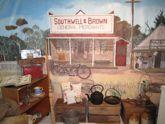
The school was built in early 1870 as a slab and bark hut measuring 30 feet by 15 feet, with a small room attached in which the teacher lived. At the time of writing his 1972 Memorial Lecture, Lea-Scarlett noted that the building '...is still in existence, although now more deservedly used as a shed on the farm of Mr Patrick Mathews at Turalla Reserve, Bungendore' (op. cit., p. 8). His paper includes a photograph of the shed as reconstructed there. It still stands on the property 'Turallo Reserve', visible from Mathews Lane.
Plumb (an Anglican) found himself in the midst of bitter conflict between the Roman Catholic and Anglican selectors in Wyanga, and his own behaviour (including his heavy drinking) exacerbated conflicts he had with the local selectors and with the Catholic hierarchy.
The school opened as a private school in early 1870, though later in the year it became non-viable as the Catholic pupils were withdrawn by their parents. The only pupils remaining were those of John Lee and Thomas Smith, and those men provided some financial support to Plumb as their private teacher.
In early 1871 a Provisional School was established in the single building that then existed in Sutton, a weatherboard building used as a Wesleyan chapel that had been moved there from the Mac's Reef goldfield once the village of Newington was dismantled. Plumb was appointed as the teacher there, with some sources (e.g. Gillespie 1999) stating that the Sutton and Wyanga schools were half-time schools, with Plumb attending them on alternate days. Conflict and chaos reigned, however, with Plumb's appointment to the Sutton school ending in September 1871. He again became a private tutor to Smith's and Lee's children as there were not enough pupils for the Wyanga school to be viable as a Provisional or Public school.
In August 1872 the Dept of Education recognised it as a Provisional School, with the teacher being Mrs Mary Whyte, the daughter of selector Edward Murphy; she had no teacher training. By this time Plumb had left Wyanga.
The school closed, never to re-open, in December 1874. In the same year the land surrounding the school site was selected by Michael Byrnes, as can be seen on the early maps, though the school site remained excised from the selection.
Today
As you walk, ride or drive along Weeroona Drive, at 3 km from Norton Road and 2 ½ km from Denley Drive, look to the east, down towards Reedy Creek, and think of the selectors' children walking, or perhaps riding their horses, to Wamboin's Wyanga school, some 150 years ago. I do!
Teachers
• Samuel Elphinstone (sic) Plumb: August 1871 to May 1872;
• Mrs Mary White (Lea-Scarlett spelled it 'Whyte'): June 1872 to July 1872;
• Mrs Mary Anne (Lea-Scarlett spelled it 'Ann') White: August 1872 to December 1874.
[Source: Gillespie 1999. Note that some of these details differ from those provided in Lea-Scarlett 1972.]
Sources and further reading
Much of this article draws on Lea-Scarlett, EJ 1972, 'Magnum Bonum Plumb--terror of the Australian bush. A study of the teaching career of Samuel Edmonstone Plumb', Descent, vol. 6, pt. 1, T. D. Mutch Memorial Lecture, read before the Society of Australian Genealogists, 17 August 1972, pp. 3-29. Parts of the Lecture's content is summarised in Lea-Scarlett, EJ 1972, Gundaroo, Roebuck Society Publication no. 10, Roebuck Society, Canberra, pp. 68-9.
Gillespie, LL 1999, Early education and schools in the Canberra region: a history of early education in the region, The Wizard Canberra Local History Series, L. Gillespie, Campbell, A.C.T.
Lord, R 1996, Sutton Public School: 125 years of education: 1871-1996, Sutton Public School, Sutton, NSW.
McDonald, D 2018, 'The parish of Wamboin: its creation and the parish map', The Whisper, November 2018, p. 20, .
New South Wales, Department of Lands 1967, Map of the County of Murray [cartographic material]: Eastern Division, N.S.W. / compiled, drawn & printed at the Department of Lands, Sydney, N.S.W, Dept. of Lands, Sydney, nla.gov.au/nla.obj-598629458.
Appendix 1: the origin of the name 'Wyanga'
'Wyanga' is almost certainly an Aboriginal word. Sutlor (1909) recorded that 'wyanga' is from the Port Jackson language, meaning 'mother'. This is reflected in one of Australia's most respected Aboriginal community-controlled health services, the Redfern-based Wyanga Aboriginal Aged Care. They refer to 'Wyanga (Earth) Malu (Mother)' wyanga.org.au/our-historystory and 'Wyanga: "Mother – the core of Aboriginal people's spirit"' redfernoralhistory.org/Organisations/WyangaAboriginalAgedCare/tabid/219/Default.aspx. Various dictionaries of Aboriginal words, published after Sutlor's piece, also refer to 'wyanga' meaning 'mother' in the Port Jackson language (e.g. Thorpe 1921).
Also in Sydney is the Aboriginal cultural tour company Wyanga Malu, which they translate as 'Earth Mother' kotahitourism.com/sydney-tours/wyanga-malu/.
Wyanga is also a rural locality and railway station in central NSW on the Parkes-Narromine railway line, 26 km south-west of Narromine. This location is in the traditional country of the Wiradjuri people, and we note that one of the two founders of Redfern's Wyanga Aboriginal Aged Care, Sylvia Scott, is a Wiradjuri Elder from Cowra, NSW wyanga.org.au/our-historystory.
There are a number of places called Wyangan in and around Griffith, NSW, and others called Wyangala, e.g. Wyangala Dam and village on the Lachlan River near Cowra, and Wyangala National Park, also in the upper Lachlan. And note Wyangala parish in the Boorowa LGA.
In addition, across eastern Australia are found many businesses, roads, properties, etc., called Wyanga, including a pastoral property in central Queensland near Tambo, and a winery in Gippsland.
References for Appendix 1
Sutlor, JB 1909, 'Aboriginal place names. Vocabularies by J. B. Sutlor, of Bathurst', Science of Man and Journal of the Royal Anthropological Society of Australasia, vol. 11, no. 8, pp. 160, nla.gov.au/nla.obj-521156802, p. 160,
Thorpe, WW 1921, List of New South Wales aboriginal place names and their meanings, Australian Museum, Sydney.
Appendix 2: the locality of Wyanga, and the families whose children attended Wyanga school
I am not aware of any published account of the boundaries of Wyanga during the period when the locality name was commonly used. Based on Lea-Scarlett's naming of the families whose children were candidates for the Wyanga school, and the locations of their selections relative to the school site (detailed below), it seems reasonable to suggest that the rough boundaries may have been the Lake George Range to the south and east, the middle of the current Bywong parish to the north, and the vicinity of Merino Vale Drive to the west. Such boundaries are less than five kilometres in a direct line from the school, a not-unreasonable distance for the pupils to travel.
The earliest land acquisitions in the area were by William Moore and William Guise, in 1838. Moore purchased a one square mile (640 acre) block that he named 'Creekborough'. Its south-western corner straddled the current Bungendore Road/Macs reef Road intersection. Note the current Creekborough Road named after his property. Also in 1838, William Guise, proprietor of 'Bywong' station in the Sutton/Gundaroo area, purchased (at auction) two abutting one-square-mile portions of land on Kowan Gully (Kowen Creek), south and west of the current Wirreanda Road. James (and his brother John?) Anlezark also had a 640 acre block. This was on Brooks Creek just north of the top of Smiths Gap; the Forest Road/Forest Lane intersection was the north-eastern corner of his block. James Anlezark is said to have purchased it in 1837 (Aubrey & Jenner 2011). The selectors moved in following the passage of the Crown Land Acts in 1861.
The earliest published mention of 'Wyanga' that I have found is the NSW Government Gazette of Saturday 31 Oct 1868 [Issue No. 271 (Supplement)], p. 3815: Registration of Brands Act of 1866, Brands Branch, Registrar General's Office: 'Third list of cattle brands—third notification: ... Wm. Smith, Wyango, Bungendore' trove.nla.gov.au/newspaper/article/225580026 . Lea-Scarlett identified William Smith as being one of the selectors in the area in 1870 (see above) and Smiths Gap is named after one of the two William Smiths (father and son) who lived in Wyanga, probably William John Smith (1824 - 1896).
The next mention was in the NSW Government Gazette dated 10 April 1879, a notice of a horse having been impounded 'from Wyanga, by John Lee' .
The Bungendore cemetery index includes Catherine Sparrow née Lee, birthplace 'Wyanga, near Bungendore', died 04 Apr 1899 at Bungendore, aged 35 years, father John Lee, mother Mary Jane Harriott. Catherine Lee would have been born at Wyanga c. 1864.
In Bert Sheedy's 1971 interview of Pat Mathews ('Turalla Reserve', Mathews Lane, Bungendore), Sheedy mentioned Wyanga twice, albeit very briefly, as if it was (to him and Mathews) a familiar name for that locality. See the 9 minutes 0 seconds point in Session 1, and 26 minutes 50 seconds in Session 2.
Families who undertook to send children to Wyanga school in April 1872
Source of the names: Gillespie 1999, p. 69.
William Smith
Selections in SE corner of Bywong parish immediately east of Creekborough (William Moore) and north of John Anlezark's block (Wm Smith ACPs 1873, 1874, 1882)
Other Smiths there as well, including Thomas Smith and TW Smith. Smiths Gap was named after a William Smith.
Joseph McEnally
I cannot find any blocks in his name within a few miles of the school.
Bernard Cunningham
Blocks on the eastern side of Brooks Creek between it and the escarpment, Bywong Parish, CP 1864, ACPs 1873 1874 1875, 1879, 1881, 1882 and 1890, about 3 miles NE of Wyanga school.
John Walker
Selections immediately north of Lee's, i.e. in the triangle of Macs Reef Road and the (Weeroona area) crown road. Also immediately NE of Moore's 'Creekborough'. CPs 1880 & 1881 (J Walker), ACP 1888 (J. Walker Jr).
Purchased 'Creekborough' from William Moore.
Walker was from County Kildare. His brother James married a girl who was a Souper. In Ireland, these were Catholics who, if they renounced their faith they were given a bowl of soup and automatically became Church of England. At the time of the 1804 Fenian uprising John Walker was said to have informed on the (Catholic) rebels. Three men were appointed by the Fenian Brotherhood to follow Walker to Australia and kill him which they did during a wallaby hunt on 'Bolero' station (near Adaminaby). It is believed that McCoy (squatter at Wanniassa) come out to Australia first and may have brought the information about James Walker being a traitor. Because of this family experience, John Walker never went outside his house with unless he was carrying a double-barrelled shotgun. Source: Lea-Scarlett 1972.
Edward Murphy
Cannon (2015) states that he received the first land grant in the parish of Wamboin, 33 acres, 10 Sep 1857 (well before the parish was created). See his block, parish no. 9, 30 acres, the top-right-hand corner touches Bungendore Road at the northern parish boundary, one mile north of the Wyanga school.
Also blocks south of upper Yass River/Cohen Creek, including CP 1879, ACPs 1881, 2 miles from the school (i.e., the current Merino Vale Drive area). Obviously, this was not the first land grant in the parish of Wamboin depending, though, on what definition of a land grant and of the parish of Wamboin one uses.
John Lee
See above, and William Lee and HH Lee
Michael Byrnes ('Byrne' on the parish map)
The school block is on one of his selections, 1874. His other nearby blocks were selected in 1870 and 1875, and he had a land grant (?) of 47-3/4 acres straddling the creek immediately north of the block which surrounded the school.
Thomas Smith (brother of William Smith?)
Thomas Smith had many selections on and close to Brooks Creek, near the Lees, south to the parish border, about 2 miles from the Wyanga school.
References for Appendix 2
Aubrey, K & Jenner, K 2011, The story of John Anlezark & Mary Anne Doyle 1812-1889, the authors, Hazelbrook, NSW.
Cannon, Geoff (compiler) & Department of Land and Water Conservation New South Wales (issuing body) 2015, The first title holders of land in the County of Murray, the author, Green Hills, NSW.
Gillespie, LL 1999, Early education and schools in the Canberra region: a history of early education in the region, The Wizard Canberra Local History Series, L. Gillespie, Campbell, A.C.T.
Lea-Scarlett, EJ 1972, 'Magnum Bonum Plumb--terror of the Australian bush. A study of the teaching career of Samuel Edmonstone Plumb', Descent, vol. 6, pt. 1, T. D. Mutch Memorial Lecture, read before the Society of Australian Genealogists, 17 August 1972, pp. 3-29. Parts of the Lecture's content is summarised in Lea-Scarlett, EJ 1972, Gundaroo, Roebuck Society Publication no. 10, Roebuck Society, Canberra, pp. 68-9.
Mathews, P 1971, Pat Mathews interviewed by Bert Sheedy for the Bert Sheedy and Marj Sheedy oral history collection [sound recording], recorded 16 January 1971, at 'Turalla Reserve', N.S.W.,
[Article contributed by David McDonald, email : dnmcdonald.id.au]
Location Map
Teachers
- Plumb, Mr Samuel Elphinstone
08/1871 - 05/1872 - White, Mary
06/1872 - 12/1874
NSW Government schools from 1848
- Wyanga (external link)
< Early Canberra Government Schools
If you are able to assist our work of identifying, documenting, and celebrating the early bush schools of the Canberra region, please contact us or .